Bam; The History of The TownBam
----------------
The History Of The Town
Siamak D. Ahi
In search for hitory of Bam, encyclopaedia iranica is the most reliable and concise source to begin with. Unfortunately it covers until mid 1970s, when probably the title "Bam" was published.
The second problem is the language of iranica, which is meant for scholars and researchers. Iranica, uses special fonts, characters and phonetics not used in every book. Provides lots of references in the middle of sentences and finally making reading and following the story hard and slow.
Here, I tried to transfer that history in simple text, without missing any fact. and write it with commonly used fonts. I deleted many references and added subtitles to make the history simple to follow. --Siamak D. Ahi
Bam, in Arabic Bamm, is a town located in southeastern Iran on the southwestern rim of Dasht-e Loot basin. At an altitude of 1100m.
The Large Oasis
Bam is a large Oasis that owes its existence to the run off from Jabal-e Barez Mountains. During the wet season rivers such as Tahroud, which traverses the town, provide enough flow to run the mills. However, since the dry season last most of the year, particularly important to town is the survival of its underground system of twenty five waterways, Ghanaats.
Though Bam, at 1100m. Altitude, is generally considered hot region, Gharm-seer, is known for a variety of cold region, Saard-seer, produces.
Bam; Origins, Travellers’ Notes
The town may owe its name to term ‘Vahma’. Vahma means prayer and glorification. Whatever the case, Bam appeared for the first time in 9th/10th Century Arab geographies. Bam was founded by Sasanians during their settlement of Kerman and southeastern Iran.
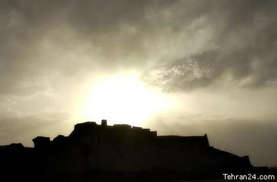
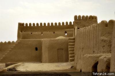
It seems to have been a walled stronghold in a region plagued by repeated incursions and banditry. Estakhri characterizes the citadel as impregnable.
Aside from date farming, Bam’s economy was chiefly based on cotton, which sustained a prosperous artisan class. Durable and prized cotton fabric, embroidered veils, cloak, kerchiefs and turbans. These products of Bam were exported to Khorasan, Mesopotamia, and even as far as Egypt.
According to Minorsky, in addition to citadel, Bam also boasted three Friday mosques. Two served the orthodox community and one the small but well-off Kharijites.
Moghadasi mentions the foul-tasting water of Bam, and Ghanaats provided the main supply.
First Original Description of Bam
In 1810 Lieutenant Henry Pottinger (1789-1856) visited the town and an original description of Bam appeared.
The accounts of arab geographers were repeated more or less by subsequent authors (Nozhat al-gholoub), and it is not until 1810, when leutanent Henry Pottinger (1789-1856) visited the town and an original description of Bam appeared.
Bam as Frontier Fortress,
In the 18th century, Bam’s role as a frontier fortress became paramount. The town was occupied by Afghans twice, in 1719 and during the period of 1721-30. Bam emerged as the forward Iranian position vis-à-vis the Gel-zay tribe, which probably with Nader Shah-e Afshaar’s authorization, established himself in neighboring Narmaa-shir.
The shi’ite Gel-zays seem to have been on good terms with Zands, for Lotf-ali Khan-e Zand fled in their direction after the fall of Keman (1794).
During the entire intervening period, the Bam was a strategically important projection of Iranian power. First it served as an Il-khanid and later as Safavid outpost in Baluchestan
Final Victory of Qajar over Zand in Bam
In 1795, the governor of Bam captured Lotf-Ali Khan and turned him to the founder of Qajar dynasty. Agha Mohamad Khan-e Qajar to commemorate his victory over the last of his Zand rivals, erected a pyramid of their skulls. Nineteen years later, it was still visible to Pottinger according to his book: Travels in Baloochistan and Sinde. London, 1816.
Coming of Baluchi Tribes
The Gel-zays were driven out from Narmaa-shir in1801 and replaced by Baluchi tribes. But the town was strongly fortified in 1810 and remained so during the first half of 19th century, due to insecurity of the region. Bam was occupied once again by Agha Khan-e Mahalati during 1840-41 insurrection and remained unsettled until around 1855.
Peace and Prosperity in Late 19th and Early 20th Centuries
The restoration of peace allowed the town to grow beyond its walls, and a new settlement was founded along the river in enclosed gardens and date groves, 1000m southwest of Bam.
Unfettered by walls and fear of invasion, Bam rapidly expanded at the end of 19th century and beginning of 20th century. In 1881, Bam lost its status as Baluchistan’s governor seat to Bam-pour. Because the governor who normally resided in Bam-pour, preferred the milder weather there.
Population Growth
Population estimates vary from E. Smith, eight to nine thousand to O. B. St. John‘s, two thousand families, and to Gasteiger‘s six thousand in 1881.
In 1895, P. M. Sykes estimated the population to be thirteen thousand. And the same figure was cited by A. Gabriel in 1928.
Growth of Commercial Activity
Commercial activity also grew apace during this period. Bam, Bazar was considered “small and Poor” by St. John, “Miserably small and Insignificant” by E. Smith in 1872, and it is called “little” by E. Sykes in 1895.
But in 1928, it seemed bustling to A. Gabriel; the covered bazar consisted of two distinct parts. A separate Zoroastrian section was occupied by some fifty Parsi merchants. Bazar was the site of felt hat, Kolaah, and sandal, Maleki, manufacturing . The Bazar also served as central distribution point for the regions agricultural products and handicrafts.
Henna, indigo, rice and dates were exported to Kerman, and objects made by artisans in Yazd and Kerman, reached the east of Iranian Baluchestan through Bam.
Bam in 1970s
Today Bam remaind an important commercial hub and the seat of its own county, shahrestan, and has an enhanced administrative role. As of 1973, the Bazar contained 576 commercial establishments, 105 itinerant merchants. There are several small scale building material factories and food processing plants, primarily dates and citrus.
The Overall population has grown from 15.737 in 1956, and to 21.761 a decade later. In 1976 it reached 30.422, most of which were engaged in agriculture.
In contrast to Narmaa-shir with its highly diversified agriculture, Bam agriculture in the last quarter century has come to be virtually dominated by dates and citrus farming, which are mainly marketed in Tehran.
In recent years however, certain grains and alfalfa have been cultivated among fruit trees. They provide many yearly harvests of winter feed for livestock, principally sheep and goats.


